Mind the Gap!
The Horsham Green Spaces group have created an animated map showing how Horsham District’s large urban areas have expanded since 1980. The map highlights just how much the green gaps between our urban communities have shrunk over the last forty years and builds on Sussex Wildlife Trust’s development of a Nature Recovery Network plan in conjunction with Horsham District Council.
Gaps may soon be extinct in Horsham District...
Our gaps need proper protection.
As planning decisions bring the borders of our urban communities closer together, the need to protect our remaining gaps through well founded planning policy becomes more urgent and needs to be addressed in the forthcoming Local Plan
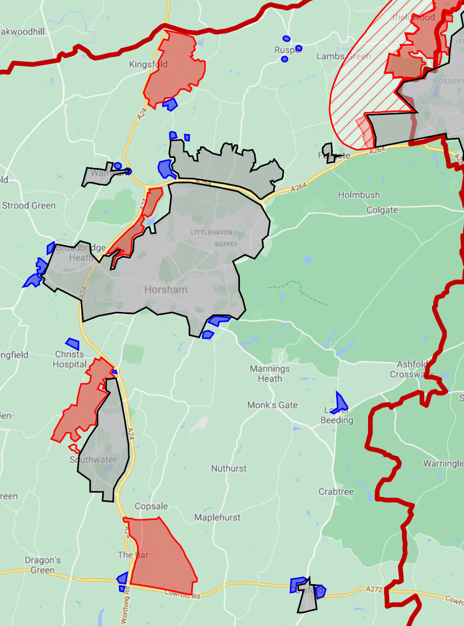
Close up of Horsham urbanisation in 1980
Close up of Horsham urbanisation in 2020 with Local Plan proposals
To view the map in detail, download the PDF and view full-screen. As you move through its seven pages the map builds from 1980 through 2000 to the present day and shows the potential impacts of Horsham District Council’s Local Plan.
Gaps benefit people and wildlife
Gaps between communities benefit:
People - Fostering a sense of community and belonging and providing access to large open green spaces.
Wildlife - Providing vital porous links enabling migration through the landscape
Existing gaps are under threat
Some strategic and small sites in the Local Plan will reduce existing gaps further, for example:
the development at Buck Barn starts about 600 metres from the southernmost extent of Southwater
the Homes England West of Crawley proposal is shown in their literature as extending to the edge of Faygate, which will leave just a one field gap between the western extent of Crawley and the eastern extent of the North Horsham Development’s business park.


